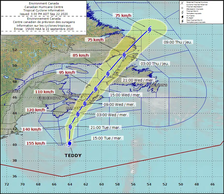
Photo courtesy Environment Canada.
The province is already seeing the first effects of Hurricane Teddy.
Environment Canada meteorologist Bob Robichaud says they expect the storm to be downgraded to a post-tropical storm before it makes landfall.
Robichaud says the province is already under the effects of the massive offshore storm’s leading edge.
“We’re looking at probably close to 1000 km across; in terms of the circulation of the storm and the tropical storm-force winds,” he says. “That’s a huge, huge storm in terms of size.”
Robichaud says storm surges along the Atlantic coast have already begun.
He says they expect the storm surges will peak overnight Tuesday and into Wednesday morning.
“There is still a risk of costal flooding as a result of the waves, and the storm surge, and the high tide combined.”
He says the brunt of the storm will come ashore early Wednesday.
Robichaud says it’s still squarely set to hit the coast on the eastern shore and sweep up through Cape Breton, dumping to 50 to 75 mm of rain to the west, as far out as the centre and northern regions, and winds to the east, up to 100 km/h on Cape Breton.


