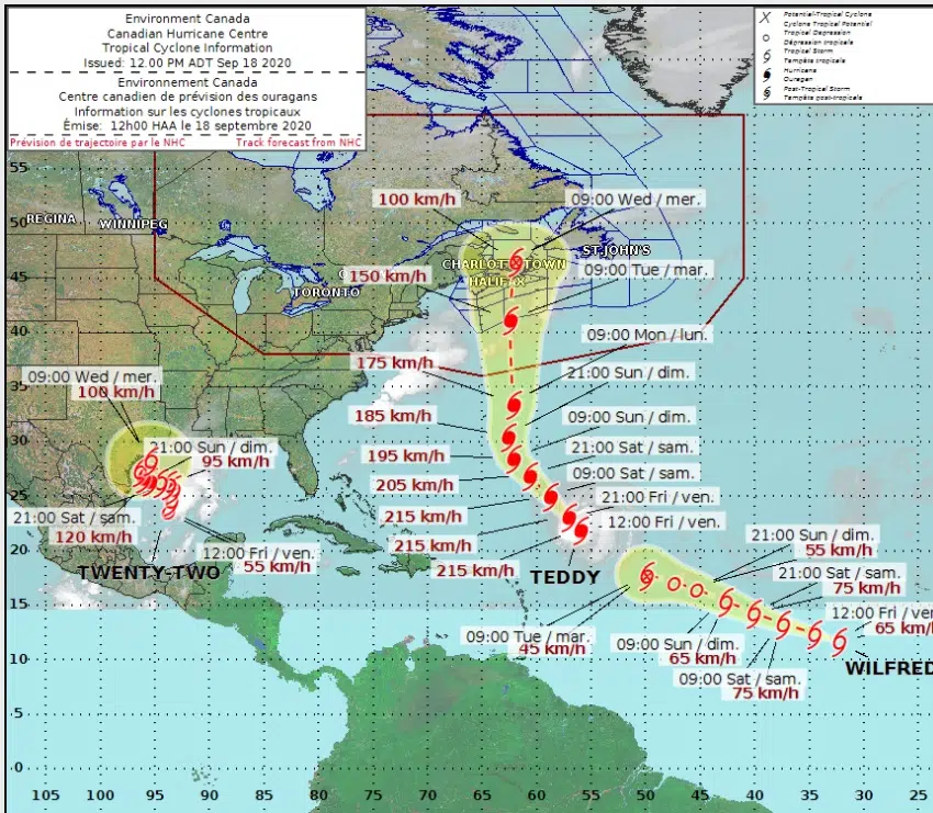
Hurricane Teddy (Photo: Canadian Hurricane Centre)
Hurricane Teddy is still days away, but models show it could have an effect on parts of Atlantic Canada.
Environment Canada Meteorologist Jill Mapea says the current track has the storm moving through Central Nova Scotia and parts of New Brunswick, as a post tropical system, “Basically the Southeastern and Eastern parts of the province have the greatest chance of being adversely affected by heavy rain and strong winds and possibly storm surge.”
The model shows potential winds of up to 120 kilometres an hour on Tuesday and early Wednesday.
Mapea says they’re continuing to monitor the path closely, “Right now, we still have four days to monitor and get more details as it moves towards the Maritimes.”
She suggests getting ready early, just in case, “Probably better to be prepared then not to be prepared. As well, sometimes with limitations, especially due to COVID-19, if you were trying to get supplies or even just trying to put away the patio furniture. It’s probably better to be prepared in advance instead of trying to do everything at the last minute.”
As of Friday, Hurricane Teddy is a category four storm.
OVER THE ATLANTIC OCEAN- More views from within the eye of Hurricane #Teddy on @NOAA‘s WP-3D Orion #NOAA42 “Kermit” during the Sept. 17, 2020 research mission. Credit: Lt. Rannenberg, NOAA Corps. Follow @NHC_Atlantic for latest forecast. #FlyNOAA #NOAAat50 #science #aviation pic.twitter.com/yZCTwhzHBs
— NOAA Aircraft Operations Center (@NOAA_HurrHunter) September 18, 2020


